
Trails have been much on my mind this year and I'll be writing more about trails in upcoming blogs. This past weekend, I drove to the Black Hills to visit a friend who lives near Hill City, roughly following the Bismarck to Deadwood Stage Trail, although in my case in a Toyota. I had most of the day to make the drive, so I stopped whenever the spirit moved me and I wasn't greatly concerned about taking the fastest route. If you zoom in on the photo above, this beautiful roadside sign, south of Mandan, North Dakota, gives the brief synopsis of the history of the trail. This was my first of many stops.
When I was a child, my mother and aunt used to point out to me the remnant tracks from the Medora to Deadwood Stage Trail, as we drove back and forth from Slope County to Rapid City. I come by my fascination with trails (and with history in general) honestly, from these two grand ladies. My mother took her children to hundreds of museums and historic sites and old forts and such, while my father fished. She was interested in these places and, in her wisdom, she knew that we would benefit from these visits as well. I think we did, immeasurably.
I am deeply a western girl. In the course of my life, other than a stint in Nashville for graduate school and a few years in Okinawa, I've always lived in the American west. The west is where my soul feels most centered. When my husband and I searched for a house, we looked at dozens in Mandan, hoping to remain "in the west", but, alas, the house we knew was the best fit for us was in Bismarck so we capitulated. Nonetheless, we are just a half mile on the east side of the Missouri River so I think the argument is strong that we are still in the western part of the United States. Certainly, we are west of the 100th meridian. So that is settled.
As Henry David Thoreau wrote, "westward I go free."
We find that we also tend to do most of our traveling in the western portion of the US or Canada. Sometimes we have to simply resolve to go east, to see family and sites in the east we want to see, and to fulfill our goal of visiting all of the national parks.
Back to my adventure. I hardly needed a map for traveling this landscape, as I know it so well, but, since I did venture on some new ground, I consulted Google Maps a time or two. As I drove along, I crossed well-known rivers, the Cannonball, the Grand, and the Moreau.
Near the South Dakota border, I began to see lark buntings. On the seat next to me, I had a box of CDs to listen to and snacks. Memories flooded back to me of trips to the Black Hills in our family Ford LTD, listening to the Carpenters on an 8-track tape, singing along to pass the time. Today it was Abbey Road, Roseanne Cash, and the Dixie Chick's "Wide Open Spaces".
The landscape changed from agricultural to native prairie and east of Faith, SD I spotted this year's first (for me) upland sandpiper. The sere landscape was a testament to the severe drought the Great Plains is experiencing. How wonderful it was to be in a car, alone, driving across the big open, with the knowledge that at the end of the day I'd be with a good friend.
Here and there the landscape was dotted with hay bales and cows and harvested winter wheat, but mostly there was grass and blue sky. On the margins of the highway were sunflowers and milkweed (the main food source for butterflies). I have a deep attachment to sunflowers as my earliest memory is from when I was about three or four and, on a Slope County scoria road, traveling to my maternal grandparents' ranch. The roadsides were thick with them. No doubt I was hanging my head out the window, excited to see my Grandma Lily. My memory is of a tunnel of sunflowers.
 |
| Blooming Milkweed |
 |
| I can't quite get used to the turquoise plastic webbing that is used in many instances on hay bales these days. |
 |
| Big Bluestem Grass (aka Turkey Track Grass) |
 |
Black Angus cattle, the reason for the hay bales
|
I traveled through many small South Dakota towns.
 |
| Sue. In tribute to the large T-Rex fossils that were found near here by Sue Hendrickson, as described below. |
After an ice cream break at Howes Store, I continued on by White Owl, SD.
Near here I saw some pronghorn antelope. Finally, Bear Butte came into view, on the margins on the distant Black Hills. Bear Butte (supposedly its earlier name was "Bare Butte" due to the lack of vegetation on its slopes) is an iconic landmark in this area.
I've hiked to the top of Bear Butte a couple of times and recommend it. Please be respectful to the Native's culture as this is considered a sacred area. Some accounts report that Crazy Horses' body was taken here by his family after his assassination at Fort Robinson by General George Crook's soldiers. It has been the site of many very large Native American gatherings.
On this particular day, I did not take the time to stop at Bear Butte, but, rather, drove along the Belle Fourche River where I spotted some red-headed woodpeckers in the cottonwoods. Instead, I stopped in Sturgis, on the edge of the Black Hills, for gas. Sturgis is the site of the world famous motorcycle rally, held in August, and the evidence of this is everywhere.
 |
| One lodge that has been built for motorcycle mania. Sturgis sprawl is evident in all directions. |
As I drove, I thought of many trips that I took as a teenager to the Black Hills. Rapid City was the metro area to which we traveled because my parents would go to the Base Exchange at Ellsworth Air Force Base, for supplies, and my older sister's orthodontist was in Rapid City. In fact, until I was in college, I only traveled twice from Slope County to Bismarck. I was born at Ellsworth AFB so returning to this area is, for me, something of a homecoming. While ranching in Slope County, we'd also take visiting family to the Black Hills as it is the major tourism destination and my father LOVES to fish! Our Luther League group would plan an annual trip to Terry Peak (the Catholic kids would go too) and, although I've not downhill skied for almost thirty years now, I became quite a good skier, and always looked forward to trips to Terry Peak.
Finally, as I drove toward Deadwood, I saw my first official signpost for the Black Hills National Forest. A roadside sign for "Custer's Crossing" caused me to make a screeching stop. Alas, there is nothing left but the base of the sign. This sign described the time when Custer traveled from Fort Lincoln (near present-day Mandan) to the Black Hills in an 1874
expedition, following along much of what would later become the Bismarck to Deadwood Stage Trail. There are many excellent books about this expedition. One book I particularly like is
Exploring with Custer which contains period photographs taken during the expedition alongside current photographs of the same areas.

Next, I drove past Trout Haven and am flooded with many childhood memories. When we would drive past the promotional signs for this place, we would beg my road warrior father to stop. Surely, we hoped, such a place would be of interest to him as there would be fishing. Eventually, we understood that my father was far above this sort of fishing and was bound for the mountain streams and lakes. Mostly we were desperate for him to stop and let us use the bathroom and stretch our legs. It would be a bonus to experience these tourist traps, advertised all around us. Yet, to this day, I've never done anything but drive right by Trout Haven. I was due at Valerie's place. I crossed Box Elder Creek and proceeded onward.
 |
| Pactola Dam, one of the many places in the Black Hills where we camped and fished. It was a busy summer day on the water. |
My friend, Valerie Naylor, is the retired Superintendent of Theodore Roosevelt National Park. One of her homes is near Pactola Dam. She actually has a cabin and a cottage. Pine Cone Cabin and Prairie Creek Cottage, to be specific, where she lives with her Beagle, Jetta, and her cats, Spirit and Diablo.
 |
| Pine Cone Cabin |
 |
Prairie Creek Cottage, with her newly acquired bison "herd"
|
When I got out of the car, the scent of pine on this warm summer day filled my senses. It was 92 degrees in Sturgis, but this high in the mountains it was down to 86 degrees. The Smokey the Bear sign at Pactola Dam informed me that the fire danger was "Very High".
Valerie greeted me and we headed out to haul water to the cattle boarding on her land.
Next up was to Hill City for a matinee, an indie film called
"Lakota Girls" where we joined Meg. The film was shown in a makeshift theater on the second floor of a former bar and restaurant, the Chute Rooster. The filmmakers and several of the stars were in attendance. Val likes movies and so do I.
 |
| Meg and Val |

Soon enough it was time for a good night's sleep among the pines.
Day two started with French press coffee and quiet enjoyment, followed by an foray to Friendship Tower on nearby Roosevelt Peak, something that was on my "list of things I'd not yet done in the Black Hills".
A short walk along the talus slope past the descriptive signs brought us to the stonework tower, built as an effort spearheaded by Seth Bullock in tribute to his friend Theodore Roosevelt.
 |
| Valerie and her Beagle Jetta on the trail |
 |
| Aster |
 |
| Talus Slope |
 |
| A brief section of trail goes through ferns |
 |
| I'm impressed by the stonework and cannot help but think about Rapunzel |
 |
| Black Elk Peak (formerly Harney Peak in the distance, the highest point in South Dakota. I've hiked to the top of this peak, the hard way. But that is another story. |
 |
| Bear Butte in the distance |
 |
| An offering of aster |
 |
| Deadwood Public Library |
 |
| A clever use of the old Sinclair Station, turned to a fun lunch spot with an adjoining glass studio, called Mind Blown Studio. |
 |
| Glass Studio |
 |
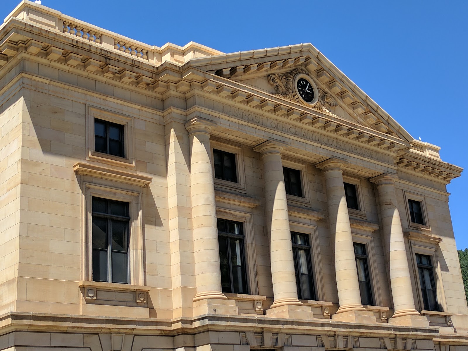
| Courthouse, now Post Office, in Deadwood, SD |
 |
The old courthouse in Deadwood, SD
|
Somewhere along the trail to Friendship Tower, I mentioned to Valerie that I'd never been to Crooks Tower. Because I said I'd like to show my elderly father a picture of said visit, we agreed that this was a priority and hatched a plan for Day Two.
Crooks Tower, elevation 7137 ft, is the highest point in Lawrence County, SD and the fourth highest point in the Black Hills. The tower is no longer there. You need a Black Hills National Forest map to find it (even better, buy a Crooks Tower quad map). I don't know if the name of the high point is derived from the existence of the tower or if it was simply called this as an honor to General George Crook. There is more information available
here. If you google Crooks Tower, you'll find even more information, and sometime in the future I'm going to deep deeper into the historical periodical literature to see what I might find.
To get there, one drives through tiny Rochford, SD. Although my friend Val has lived in or near the Black Hills for many years, she'd never been there, an added bonus. It is 29.3 miles from the turnoff to Rochford on Highway 385 to the summit of Crooks Peak.
 |
| Rochford, SD |
 |
| Lillian Crook on Crooks Tower |
 |
| Looking down from Crooks Tower |
 |
| Prickly juniper |
 |
| Very pale version of Sego Lily |
 |
| A particularly vibrant Penstemon |
 |
| The limestone of the area is prominent here |
 |
| Remember my obsession with sunflowers? |
 |
| The nearest USFS campground. Somewhere near here we spotted a couple of bobolinks |
 |
| It is so wonderful to be in the vicinity of clear, running mountain water. Rapid Creek, in this photo |
 |
| These former camps are found all around the Black Hills area |
One last stop in Rochford at the tongue-in-cheek "Small of America" and it was time to say goodbye to Val and point the Toyota in the direction of North Dakota.
In Nemo, I had a very good mushroom & swiss burger and then drove on as per Val's directions in scenic Vonacker Canyon, where I saw a western tanager.
As I left Sturgis, I remembered a sign I'd spotted on the way through two days before for the Fort Meade Museum and thought "no time like the present" -- drove right up to it, paid $5, and learned more about the fort I'd driven by hundreds of times in my life.
The members of the 1874 Custer Expedition camped near Bear Butte, the first encampment of the US in the area. In 1878, Camp Sturgis was established near present Fort Meade with the final site being several miles south of there, on the edge of present day Sturgis, SD, and was officially founded on August 28, 1878. The fort is beautifully preserved and the museum is located in the old Command HQ building, which was erected in 1905. The fort is now used by the National Guard for a training site and is a VA Medical Center. The doctors and other medical staff rent many of the houses. You can learn much more about historic Fort Meade
here.
Although I did not have time to visit the cemetery, I paid silent homage to a family friend, Ron Hilden, buried here. Judge Hilden conducted our wedding ceremony and is much missed.
I'm also interested in Fort Meade because it was to here that General Crook and his troops, in the late autumn of 1876, came at the end of what is known as his "starvation march". They were in pursuit of the Native Americans dispersing after that summer's Battle of the Little Bighorn. After being forced to kill and eat their horses, they limped into the fort.
 |
| As the sign explains, it was here that the "Star Spangled Banner" was first used in military ceremonies. |
 |
| The Museum |
 |
| This caught my eye. Remember, I'm interested in trails. There is one just like this at the Cowboy Hall of Fame in Medora, ND |
 |
| I'd never seen anything like this. The soldiers in World War I engraved the spent cartridges found all around the trench areas |
 |
| This uniform reminds me of one of my father's |
 |
| My father was at Omaha Beach. This was a very interesting original map that belonged to a D-Day soldier |
 |
| This exhibit about the KKK in the area was rather shocking to me |
 |
| New homes have been built to blend into the original fort's architecture |
If you travel to the Black Hills, pick up one of these ubiquitous maps.
A thunderstorm was forming over the area, hopefully bringing some badly needed rain. I finally got serious about heading homeward, taking the route directly past Bear Butte where I intersected with another Bismarck to Deadwood Stage Trail sign, this one describing death ON the Bismarck trail (rather than "of"). I'm so grateful to the people who've erected these signs everywhere.
While I should probably have stuck to the most direct northeast route, I wanted to surprise my husband with something, given that I was so close by. So, I headed west again, to Highway 85. My friend Clay Jenkinson, in his book
Message on the Wind, calls this area "the sacred corridor" and I completely agree.
 |
| Castle Rock, SD |
 |
| One of the many pine islands (elevated areas that are vegetated by ponderosa pine) of the Great Plains, in this case, the Cave Hills and the Camp Crook area |
 |
| Crow Buttes |
 |
| As you will see upon reading this sign, there is an interesting and sad tale about the Crow Buttes locale. |
My purpose was to stop at the Crow Buttes Mercantile to pick up their world famous bacon. It is, after all, approaching BLT season at our house. Six pounds of that naughty treat was my surprise to Jim.
At Buffalo, I headed east again, driving into the Custer National Forest and the Slim Buttes. General Crook's Starvation March (also known as "Horsemeat March") took him through the Slim Buttes where skirmishes were fought with the Native Americans. Here he captured the chief
American Horse and is shown in a famous photograph with one of the guidons (triangular shaped flag) of Custer's troops (from the July 1876 battle).
As I completed my drive back to Bismarck, my thoughts were filled with so many happy memories of camping, fishing, and hiking in the Black Hills, and of so many drives through "the sacred corridor". I crossed the Missouri River and was happy to be home again, 742 miles later. Thanks, Val!


No comments:
Post a Comment